


Welcome to National Portal of Map Services
Digital India aims to establish end to end geo-spatial systems as part of Mission Mode Projects in e-Governance domain and envisages "National GIS Mission" as core foundation of location based Electronic Delivery of Services for Planning & Governance. NIC/DeitY has created Multi-Layer GIS Platform named "Bharat Maps" which depicts core foundation data as "NICMAPS", an integrated base map service using 1:50,000 scale reference data from Survey of India, ISRO, FSI, RGI and so on. Bharat maps services Platform aims to provide access to GIS data as a service to various Mission mode projects and e-gov divisions of NIC at Central and State level. The service portal enables a platform for accessing the services in a seamless manner. National Portal of Map Services contents are derived from BHARATMAPS GIS portal.
Consuming GIS services using NIC Map Service Portal

Login to Bharatmap Service
(Login with official email address)

Choose GIS services
and give URl

Receive GIS services with
sample
template and API

Integrate GIS services with
data services to create web
application
GIS Service Statistics using NIC Map Service Portal
Service Statistics
Active Service Statistics
Ministry wise services statistics
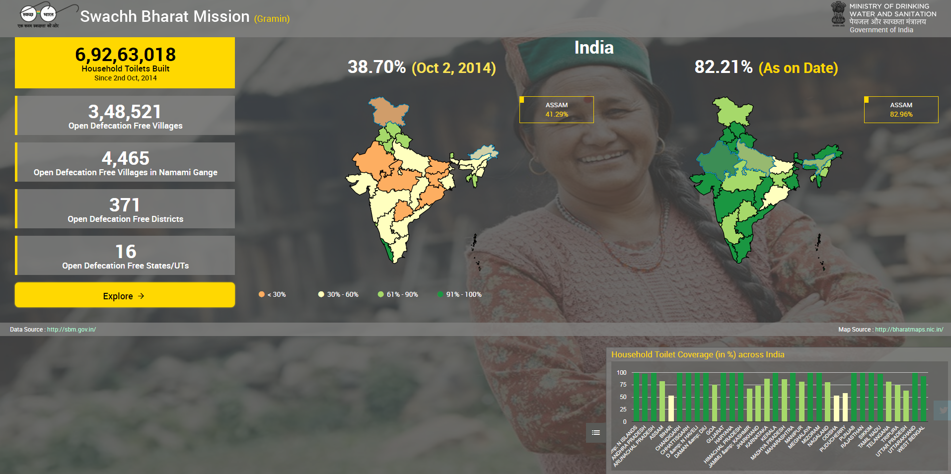
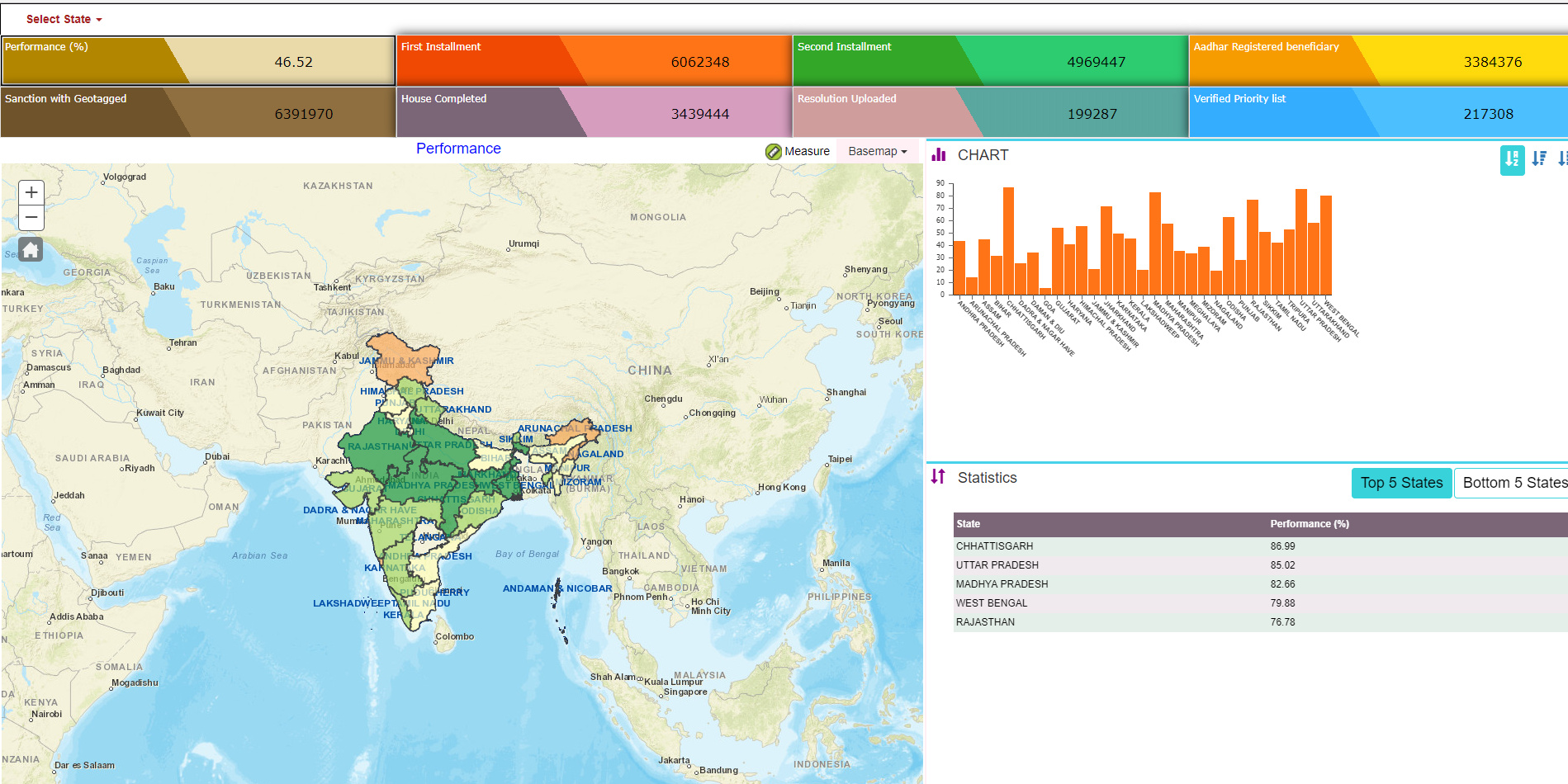
Ministry of Rural Development
ministry of electronics & information technology
ministry of agriculture & farmers welfare's project
Ministry of Panchayati Raj
mobile applications
Bharatnet progress
Punjab Sadak Sewa
Common Service Center